Whether you travel outdoors for hunting, photography, or just adventurous exploration, a map of the terrain you’re venturing into can be indispensable for ensuring a safe journey. While there are apps (and adventure watches) that do help out on that end, those who prefer physical maps they can study while chilling at camp might want to check out National Geographic’s new USGS PDF Quads service.
A free service, National Geographic, basically, allows you to download any section of the US Geological Survey’s database of topographical maps in PDF form, automatically saving it in four letter-sized sections for easily cranking out on a home printer. That’s right, all you have to do is go to the site, navigate the map to find the section you’re visiting, and click on it to get yourself a ready-to-print PDF of the entire terrain.
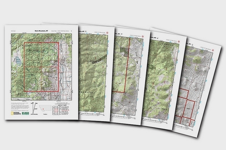
Each National Geographic USGS PDF Quad actually consists of five pages: the first page is an overview map that shows the area in context of its surroundings while the next four shows USGS quads automatically cut to fit on letter-sized paper. The maps even come with shading for hills and elevations to help users visualize the topography, making it one truly handy for those who spend inordinate time outside urban centers. If you’re the type of person who likes to travel with physical maps in hand while adventuring, this thing just might be long-missing service you’ve been waiting for.
You can check out the National Geographic USGS PDF Quads from the link below.